es no broma!! Map, compass, navigation
skills and acclimatization required!
While in Baño drinking cerveza and
practicing my Spanish with Lucia, a german guy sat down next to us who had just
biked 60 km into town! He was a nice
guy, and fluent in Spanish, so he quickly became part of our conversation. We discussed all sorts of things, and how
they differ among Germany, Ecuador, and the US.
And Lucia and I jealously heard about his travels all around the world
over the next year.
And fortunately for me, he was
headed to Cuenca next as well. I really
wanted to hike in Cajas National Park, but knew it was unsafe for me to do so
alone. After hearing about his 60 km
bike ride, I figured he’d be game for a good hike! We met up Sat night in Cuenca for beer and
decided to hike the Inca Trail-- a nice, long ~20 km hike.
In the morning, we jumped on the bus
towards Guayaquil. After both being
solicited by Jehovah witnesses on the bus with a pamphlet that asked “¿Será possible
que los muertos vuelvan a vivir?,” we jumped off the bus at the trailhead. We loaded up on a high energy breakfast,
Ecuador style: carne con arroz y plantains. And, of course, ají.
We set off on the Inca trail towards
Laguna Luspa, the first of many beautiful lakes along our hike.


We were relieved to see trail
markers, as we’d both heard that route finding in the park can be
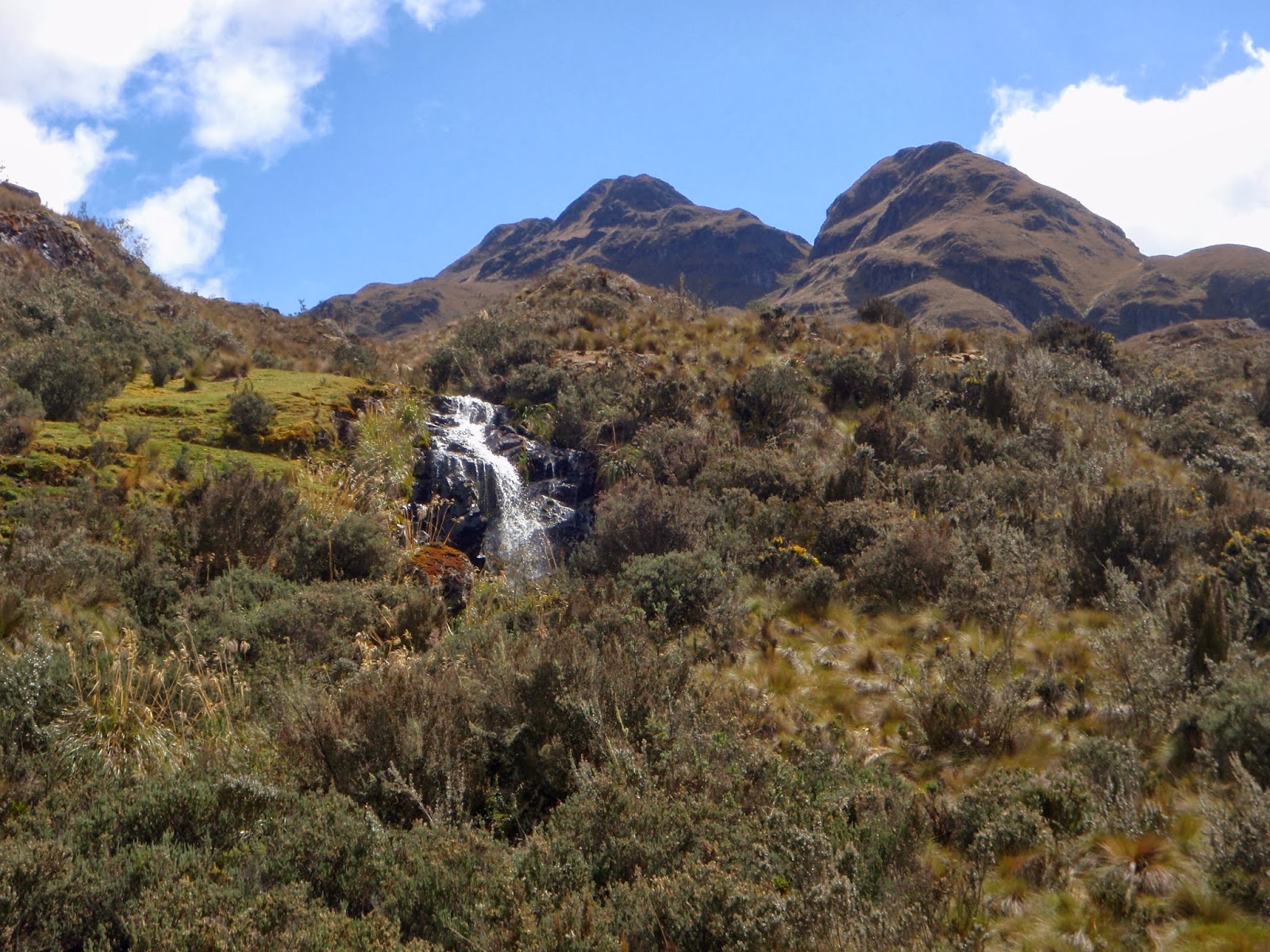
difficult. But we spoke too soon. As we reached the first creek crossing with a
gorgeous water fall, the markers ran out.


So we were probably on “trail” for
no more than a kilometer of the hike.
The rest was bushwacking and route finding fun over rolling terrain
covered with breath-taking lakes

Mountains

Flora


And alpacas y llamas!!


Literally breath taking! Or maybe that was because we were at
12-13,000 feet, breathing cold, thin air….
Fortunately, we reconnected with the "trail" just in time for the cold rain


Fortunately, we reconnected with the "trail" just in time for the cold rain


All in all, it was a fun adventure hiking in Cajas!!
Nice! So glad you got to do an awesome hike--and see Cajas :)
ReplyDeleteMe too-- it was awesome!! :) Thanks for the heads up on what to expect...you were definitely right about it being best not to go alone. "Trail" is definitely used loosely! ha
ReplyDelete